Centralize LGU WebGIS
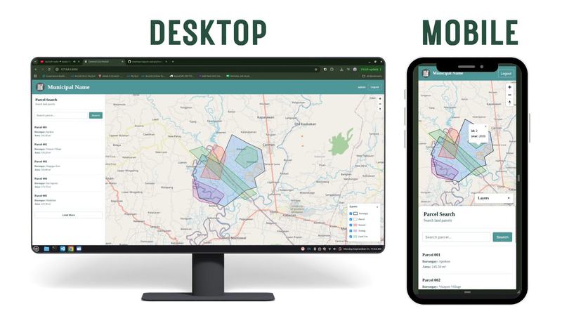
A centralized GIS platform connecting 1,000+ personnel across city offices. It transforms scattered spatial data into one controlled, accessible, and up-to-date source for the entire LGU.
The Problem
Spatial data was scattered across different LGU offices.
Teams maintained their own QGIS projects, files, and datasets. This made it difficult for other offices to find the latest data, access information from another department, or know which version was authoritative.
As more people used GIS across the city, the problem became bigger: the data existed, but it wasn't connected.
Why
The goal was not to replace QGIS or force personnel to learn an entirely new workflow.
The goal was to create a central source of spatial data for the LGU while keeping QGIS as the everyday GIS tool.
Each office could continue doing its own work, while authorized personnel controlled what data was shared and who could access it.
How
I built a centralized LGU WebGIS that connects existing QGIS workflows to one shared spatial data system.
Personnel can work in QGIS, synchronize approved datasets, and make them available to other authorized offices through the central platform.
Access is controlled by personnel and office, allowing the LGU to manage who can view, contribute, update, and maintain specific datasets.
Instead of spatial information remaining inside individual computers and offices, it becomes part of a shared city-wide GIS resource.
Impact
1,000+ personnel can be connected through one controlled GIS environment.
Different offices can access shared spatial information without manually requesting and transferring files between departments.
The result is a simpler flow:
Office GIS Work → QGIS → Central GIS → Authorized City Offices
From scattered GIS files to a shared, controlled, and accessible LGU spatial data system.
Testimonial
What They Said
"The data was already there. The missing piece was connecting every office to it."