AI-Assisted Transmission Line & Wildlife Analysis
An AI-assisted GIS application for analyzing the relationship between electrical transmission infrastructure and wildlife / public-access lands in California's San Joaquin Valley.
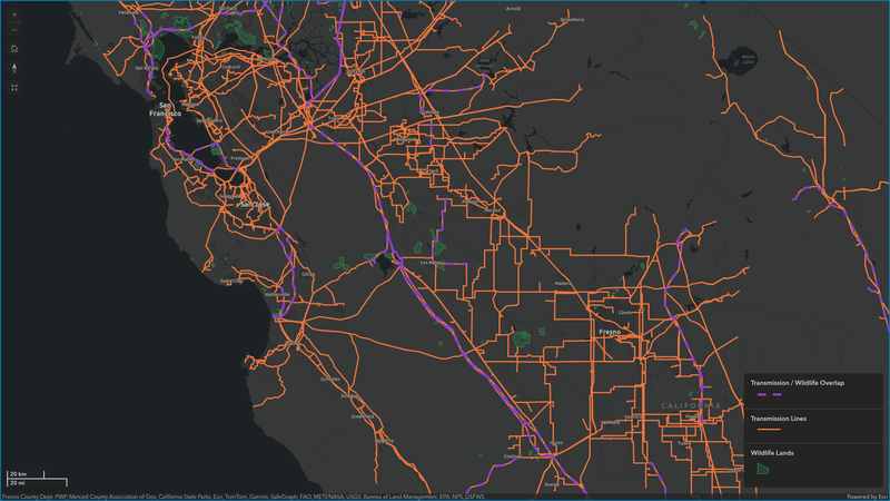
An AI-assisted geospatial analysis project exploring the relationship between electrical transmission infrastructure, wildlife areas, and public-access lands in California's San Joaquin Valley.
The project demonstrates how infrastructure and environmental datasets can be combined into a repeatable spatial-analysis workflow, with natural-language queries providing a simpler interface to the underlying GIS operations.
Problem
Energy and infrastructure projects often require teams to understand how existing infrastructure interacts with surrounding land and environmental constraints.
Answering questions such as:
- Which transmission lines intersect wildlife or public-access lands?
- Which areas are within a specified distance of transmission infrastructure?
- What infrastructure is closest to a particular land area?
- Which locations may require additional environmental review?
can involve multiple datasets and several manual GIS operations.
The goal of this project was to explore a more accessible workflow where users can begin with the spatial question, while the system handles the required GIS operations.
Data
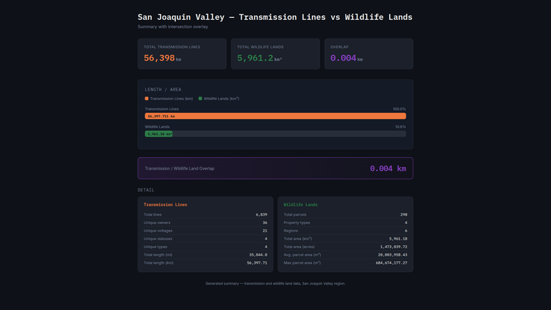
The analysis combines spatial datasets representing:
- Electrical transmission infrastructure
- Wildlife lands
- Public-access lands
- Environmental and geographic boundaries
These datasets are standardized and queried together to identify intersections, proximity relationships, distances, and other spatial patterns.
Workflow
The system follows a simple analytical pipeline:
Spatial Question → Query Interpretation → GIS Operation → Spatial Database → Analysis Result → Map / Dashboard
For example:
Which public-access lands are within 1 km of transmission lines?
The system translates this question into structured spatial operations:
- Select the relevant transmission infrastructure.
- Evaluate the 1 km proximity area.
- Compare transmission infrastructure with land boundaries.
- Identify matching geographic features.
- Calculate and summarize the spatial relationships.
- Return the results through an interactive interface.
Operations include spatial intersections, proximity analysis, distance calculations, spatial joins, filtering, and aggregation.
AI-Assisted Spatial Analysis
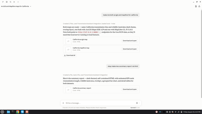
The AI layer acts as an interface to GIS analysis, rather than replacing the GIS engine itself.
User → LLM → MCP Tools → Spatial Operations → DuckDB Spatial → Result
Natural-language questions are interpreted by the language model and connected through Model Context Protocol (MCP) to defined spatial-analysis tools.
The actual geographic calculations are performed using deterministic spatial operations in the database.
This separates language interpretation from spatial computation, helping keep the analytical workflow structured and reproducible.
Output
The workflow produces spatial results that can be explored through:
- Interactive WebGIS maps
- Infrastructure and land overlays
- Proximity and intersection results
- Filtered geographic features
- Spatial summaries and counts
- Dashboard-based analysis
- Natural-language GIS queries
The same spatial information can also be exposed through different interfaces, including ArcGIS, MapLibre, and custom web applications.
Why It Matters
Infrastructure analysis rarely depends on a single dataset.
Transmission infrastructure often needs to be evaluated alongside land ownership, environmental constraints, protected areas, roads, parcels, terrain, and other geographic factors.
This project demonstrates a foundation for combining those datasets into a reusable spatial-analysis system.
The same approach can be extended toward applications such as:
energy site screening, infrastructure planning, environmental constraint analysis, land suitability analysis, and geospatial decision-support systems.
Technologies
Spatial Analysis: GIS · DuckDB Spatial
AI Interface: LLM · Claude · MCP
Mapping: ArcGIS · MapLibre
Application: Custom Web Interface · Spatial Data Processing